Nevada, a land of glittering casinos and sprawling deserts, harbors a history far more dynamic and engaging than its glamorous facade suggests. Charting the lines that define this state’s unique shape was a decades-long endeavor, and arguably, still ongoing. From international treaties to local disputes, gold rushes to surveying errors, Nevada’s history is a complex narrative interwoven with politics, economics, and human perseverance. To truly understand Nevada’s formation and evolution, there’s no better path than delving into the books that chronicle the events and people who shaped this state.
Northern Border: A Historical Miscalculation
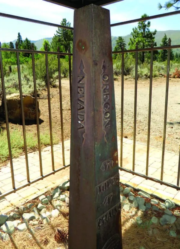
Nevada’s northern border, adjoining Idaho and Oregon, ranks among the oldest surveyed boundaries in the American West. Its origin traces back to the Adams-Onís Treaty of 1819 between the United States and Spain, which designated the 42nd parallel as the dividing line. However, translating this line from paper to the physical landscape proved to be a significant challenge.
In 1871, surveyors pinpointed Nevada’s northeastern corner and marked it with a cedar post. Astonishingly, modern measurements reveal this spot to be approximately 600 yards south of its intended location. This error, coupled with other inaccuracies along the northern border, resulted in Nevada being around 50,000 acres smaller than originally planned.
The Sagebrush War and the Disputed Western Border
The area northwest of present-day Reno was once the epicenter of a heated territorial dispute. Settlers in this region were uncertain about their political allegiance, with both Utah Territory and California laying claim.
Congress established Nevada Territory in 1861, setting its western boundary as “the dividing ridge separating the waters of the Carson Valley from those flowing into the Pacific.” However, California resisted ceding this area, leading to a protracted standoff.
The dispute climaxed in the winter of 1862-1863 with a series of incidents known as the Sagebrush War. Despite its name, it was a rather amicable border conflict, with one pivotal battle consisting of only a few stray shots and a subsequent peace dinner.

After much deliberation, California retained the land between the Sierra crest and the 120th meridian. Accurately determining this meridian also proved difficult, with six different surveys yielding results varying by over three miles. The 1872 survey by Alexey W. Von Schmidt was ultimately accepted, even though he deviated from initial instructions and placed the boundary based on the actual 120th meridian.
Had Von Schmidt adhered to the instructions, Nevada would encompass an additional half million acres today.
The Fateful Diagonal: Southern Border
Nevada’s southern border with California is a diagonal line extending from the intersection of the 120th longitude with the 39th latitude down to the Colorado River at the 35th latitude. Surveying this diagonal was a complex undertaking, requiring meticulous calculations and adjustments for the Earth’s curvature.
At the diagonal’s northern end, surveyor George H. Goddard couldn’t mark the corner point as it lay within Lake Tahoe. However, he established sighting points on the shore to define the lines across the lake.
At the southern end, Lieutenant Joseph C. Ives identified the point where the 35th latitude intersected the Colorado River. However, his work was later forgotten after he joined the Confederate Army during the Civil War.

In 1872, Alexey Von Schmidt was hired to survey and mark the entire Nevada-California common border. After discovering that a shift in the Colorado River’s course necessitated moving his line, he ran out of funds and left the job incomplete.
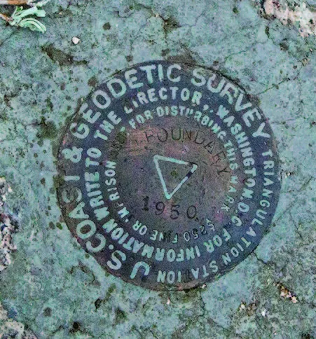
By 1889, improved methods allowed the U.S. Coast and Geodetic Survey (USC&GS) to establish a national grid. This led a new survey team to discover Von Schmidt’s errors and rerun the line. Both states accepted this version, and it remains the official boundary today.
Southern Expansion: The Nevada Boot
Nevada acquired its current southern boundary in 1867, when it took over the portion of Arizona Territory west of the Colorado River. This area, encompassing all of Clark County, is known as the state’s “boot heel.”
Congress decided that Nevada would be better positioned to oversee the anticipated population boom following gold discoveries in the region. The original boundary with Arizona ran along the Colorado River’s middle, but shifts in the river’s course caused confusion about land ownership. A compact between Nevada and Arizona redefined the border as a series of straight lines running between monuments placed along the river.
Eastern Shifts: Territory Enlarged
When Congress established Nevada Territory, its eastern boundary was the 39th meridian west of Washington. However, with the discovery of gold east of this line, Nevada petitioned Congress to move the boundary further east.

Congress granted Nevada’s requests, and the eastern boundary was shifted twice, eventually settling at the 37th meridian. These shifts took approximately 37,000 square miles from Utah Territory, effectively doubling Nevada’s size.
Future Frontiers: Wendover
A potential change may be on the horizon along Nevada’s eastern border, should local voters and Congress agree. A 15-square-mile section of Utah could be transferred to Nevada, uniting the town of Wendover, Utah, with its larger and more prosperous sister city, West Wendover.
Delving into Nevada History Through Books
For a deeper understanding of Nevada’s complex and fascinating history, reading books is an excellent way to explore the stories and events that have shaped this state. Here are a few recommended books on Nevada history:
- “Nevada: A History” by Russell R. Elliott: A comprehensive overview covering Nevada’s history from prehistoric times to the present day.
- “The Sagebrush State: Nevada’s History, Government, and Politics” by Michael W. Bowers: An insightful look into Nevada’s politics and government, as well as its history.
- “Comstock Lode” by Lucius Beebe and Charles Clegg: A captivating account of the Comstock silver rush and its impact on Nevada.
- “Las Vegas: An Unconventional History” by Hal Rothman: A unique perspective on Las Vegas’s history, focusing on the city’s development as an entertainment and gambling hub.
Additionally, you can explore research papers, scholarly articles, and archival materials for a more in-depth look at specific aspects of Nevada history that pique your interest.
Conclusion: A State in Continuous Evolution
The history of Nevada’s border formation is a testament to the complexities and dynamism of the American West. From surveying errors to territorial disputes, gold rushes to political decisions, Nevada’s boundaries have been shaped by a multitude of factors. While the state’s borders have been established for over a century, the possibility of future changes, particularly concerning the unification of Wendover, remains. Regardless of what the future holds, Nevada’s history remains a captivating and worthwhile story to explore.