Table of Contents
When I was younger, America was never a dream destination for me. I imagined a country of dry skyscrapers, crowded streets, and unfamiliar faces. But fate intervened, and work led me to this land. America unfolded before my eyes, forcing me to discard preconceived notions about a place I had never set foot in.
Indeed, America was different from what I had imagined. Instead of cramped streets, I saw wide, straight boulevards. American culture had its differences from Europe, but most of the people I met were friendly and open. And the high-rise urban areas, dwarfed by the vast nature, seemed like small islands in a vast ocean.
From the first glance, the endless green of mountains and forests, sprawling plains, interspersed with multi-colored deserts, awakened an explorer’s soul within me. I thought to myself, if there’s any place in the world suited for endless adventures, it’s this country. In that moment, I knew I would return.
And I did return, almost immediately. The Grand Circle in the American Southwest was my choice for a 3-week road trip. Before that, I hadn’t traveled far, only familiar with a few bustling cities and peaceful villages. This road trip became a significant milestone, opening up endless journeys to come.
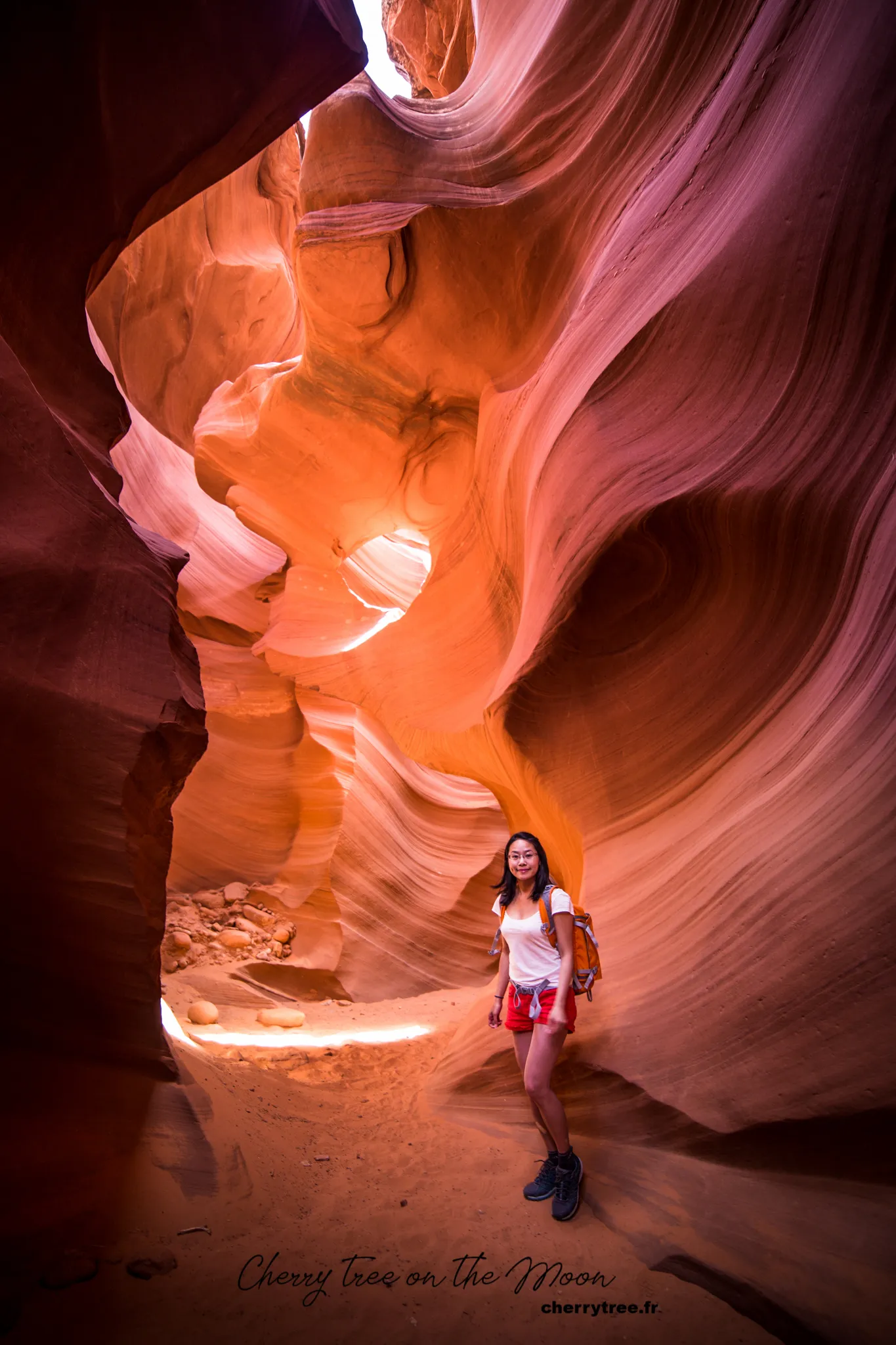
The American West is not an easy destination for those just starting their journey of world exploration. Even now, it remains the most desolate region I have ever set foot in. I still remember those nights driving swiftly in the darkness, opening the window searching for a glimmer of light, only to find utter darkness. The uneasy feeling of knowing you are surrounded by emptiness, hundreds of kilometers without a soul. The first night in Death Valley, I tossed and turned, listening to the howling of wolves echoing from afar, sometimes near, sometimes far, reverberating off the cliffs. Then another night, our campsite received a rattlesnake warning. That night, my heart tightened every time I heard a rustle under the bed, just hoping no snake would crawl out to “greet” me.
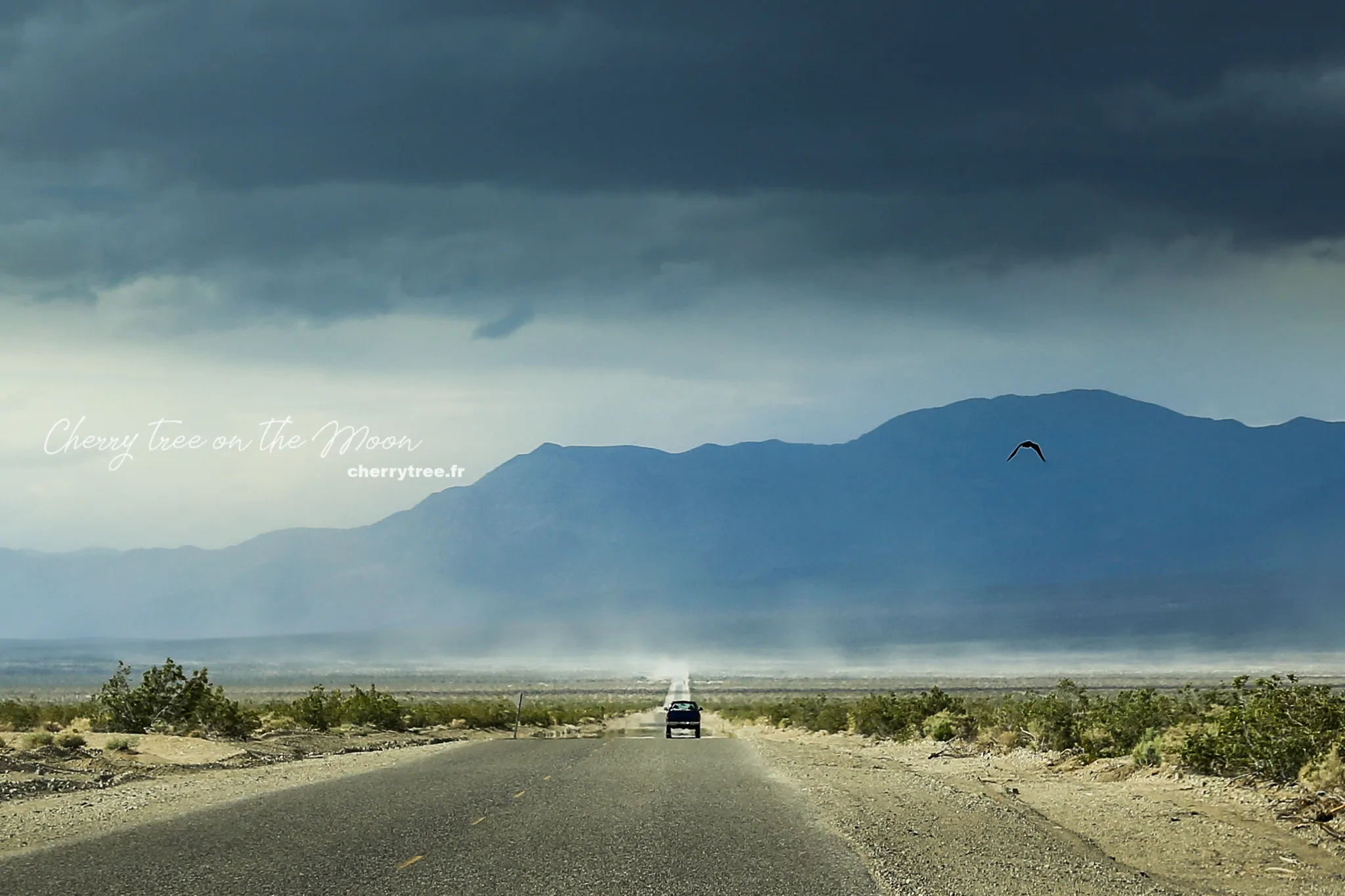
But in exchange for the initial fears, the American West offers an adrenaline rush that is easily “addictive.” Gradually, I was no longer as hesitant as before. In the vast desert, I felt as small as a grain of sand. Wild nature embraced me. On a high mountainside, I stood silently watching the sunrise gilding the Colorado River. From dawn to dusk, from day to day, before the constantly changing majestic scenery, I reveled in the vast space, enjoying my own glorious moments. The West poured into my soul gulps of brilliant golden sunshine, imbued with the taste of freedom, and I fell in love with this land without even realizing it.
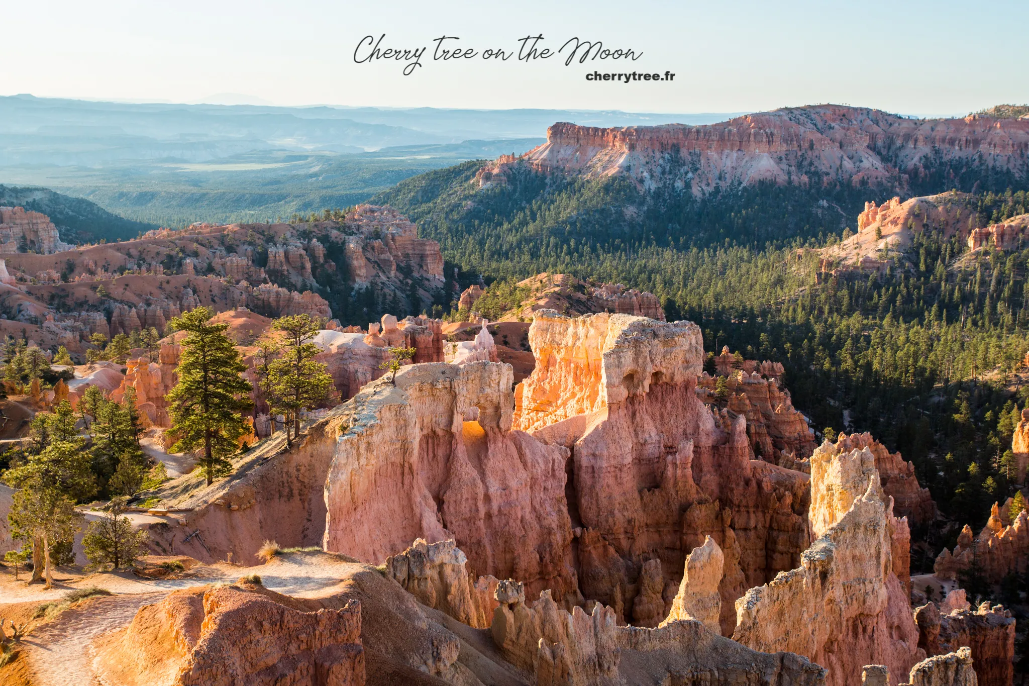
Three weeks of road trip is a long journey to recount in a short article. But three weeks is too short to explore the entire Grand Circle. At each national park, we could only stop for one to three days, like an initial “survey” to find our favorite destinations, and make a date to return.
This article will summarize my 3-week trip itinerary. Besides the majestic and enchanting scenery of the Grand Circle, which is a paradise for those passionate about landscape photography, I will share beautiful photo spots I know. The Grand Circle is mainly desert and red sandstone mountains, so sunrise and sunset are the two most ideal times to admire and capture the beauty here. Each day, I will send a few messages so you can get to the most “photogenic” locations at the most beautiful light of the day.
Now, let’s begin our journey!
3-Week Itinerary Exploring the American Southwest
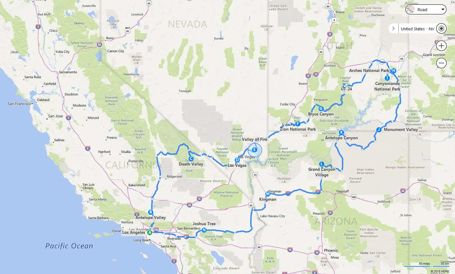
Day 1: Los Angeles – Beginning of the Journey
Arriving in Los Angeles, picking up our rental car at the airport, we began exploring this vibrant city. Not forgetting to stop at a supermarket to stock up on food and drinks for the long roads ahead. The first night, we rested in Los Angeles to prepare for our journey exploring the Southwest.
Day 2: Antelope Valley – Golden Poppy Fields and Journey to Death Valley
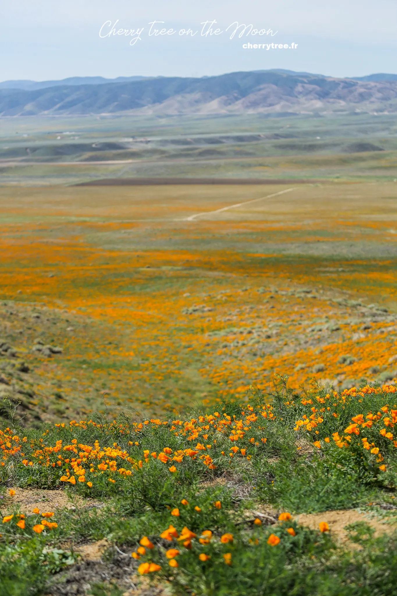
- Los Angeles – Antelope Valley (1h30, 85 miles): Our first destination was Antelope Valley, a radiant golden poppy reserve, a desert region in California. The best time to visit Antelope Valley is after 10 am when the flowers are in full bloom. The blooming season usually lasts in late April and early May. If you arrive at another time, you can skip this stop.
- Antelope Valley – Death Valley (2h45, 148 miles) via Trona Wildrose Road: Instead of taking the usual Highway 190, we chose Trona Wildrose Road to enjoy more majestic and pristine scenery.
- Overnight in Panamint Spring, Death Valley: We chose Panamint Spring as our overnight stop, preparing for a day exploring the mysterious Death Valley.
Day 3: Death Valley National Park – Magnificent Death Valley
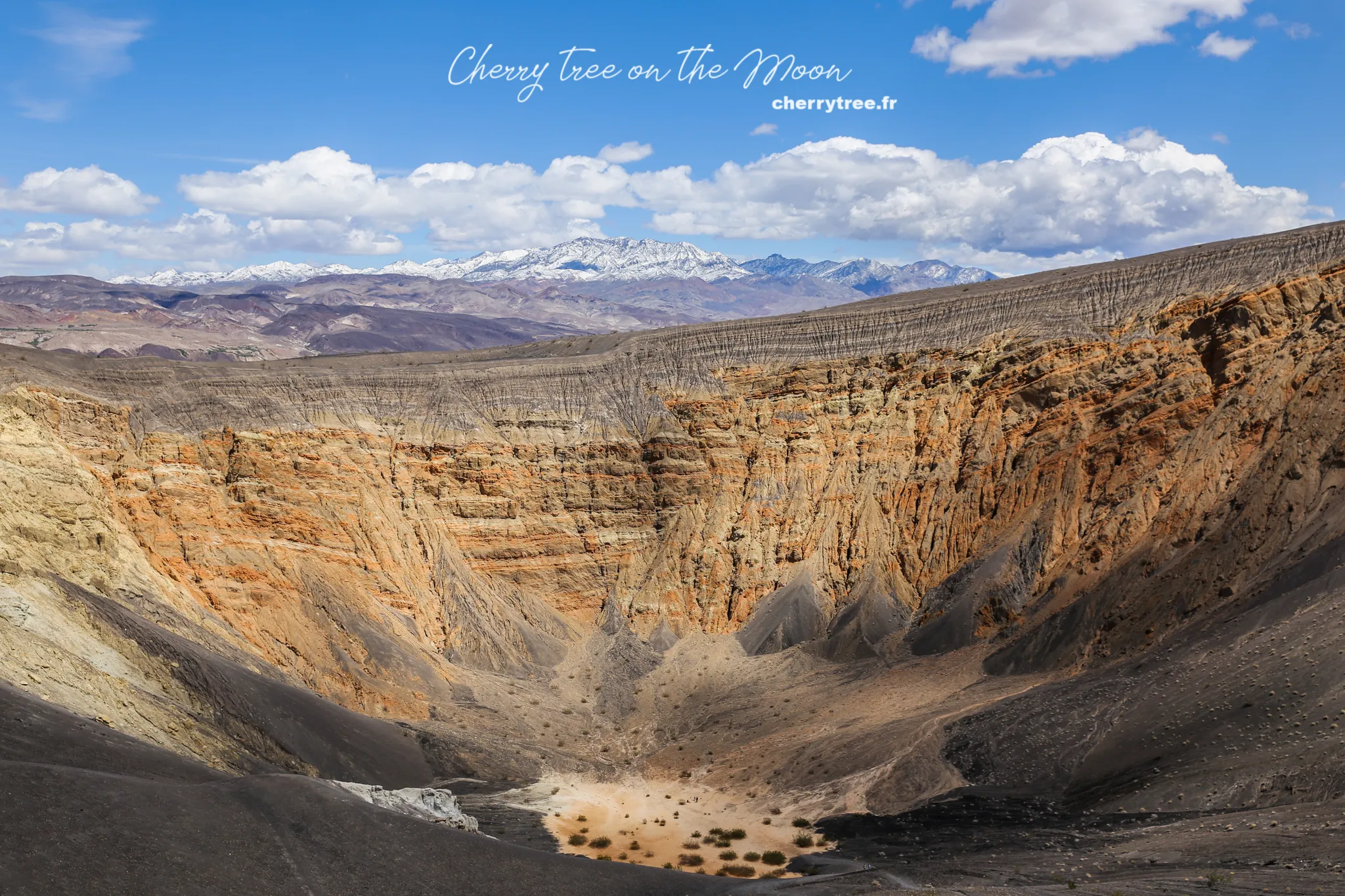
Death Valley, a national park spanning nearly 8000 km² in eastern California, is one of the hottest areas on Earth. It boasts pristine beauty and surprisingly diverse terrain, from sprawling desert dunes to white salt flats, snow-capped mountains, and extinct volcanic craters. Death Valley was one of the most impressive destinations on this trip, leaving us in awe of the wondrous beauty of nature.
- Sunrise at Mesquite Flat Sand Dunes: Early in the morning, we went to Mesquite Flat to greet the sunrise over the soft, seemingly endless sand dunes.
- Racetrack Road and Racetrack Playa: Continuing our journey, we drove along Racetrack Road to Racetrack Playa, a barren, dry lakebed, eerily flat. The rocks here mysteriously slide across the surface when there is wind, leaving long, enigmatic trails behind. Note that Racetrack Road is a 27-mile dirt road and should not be driven in bad weather.
- Sunset at Zabriskie Point: Zabriskie Point is a stunning sunset viewpoint where you can admire the eerie light covering the Death Valley landscape.
- Overnight in Furnace Creek, Death Valley: We chose Furnace Creek as our overnight stop, located right in the middle of Death Valley for easy access to explore this national park.

Day 4: Death Valley NP – Las Vegas – From Desert to City of Lights
- Sunrise at Badwater Basin: Badwater Basin, the lowest point in North America (86m below sea level), is an ideal location to greet the sunrise. You should venture deep into the salt pan to admire the stunning salt patterns.
- Artists Pallette: Near Badwater is Artists Pallette, where sandstone hills appear in a myriad of vibrant colors.
- Death Valley – Las Vegas (2h, 118 miles): Leaving Death Valley, we drove to Las Vegas, the world-famous entertainment city.
- Overnight in Las Vegas, hotel on The Strip: For convenient nighttime exploration of Las Vegas, we chose a hotel right on The Strip, the city’s most vibrant central area.
Day 5: Valley of Fire State Park – Valley of Fire State Park
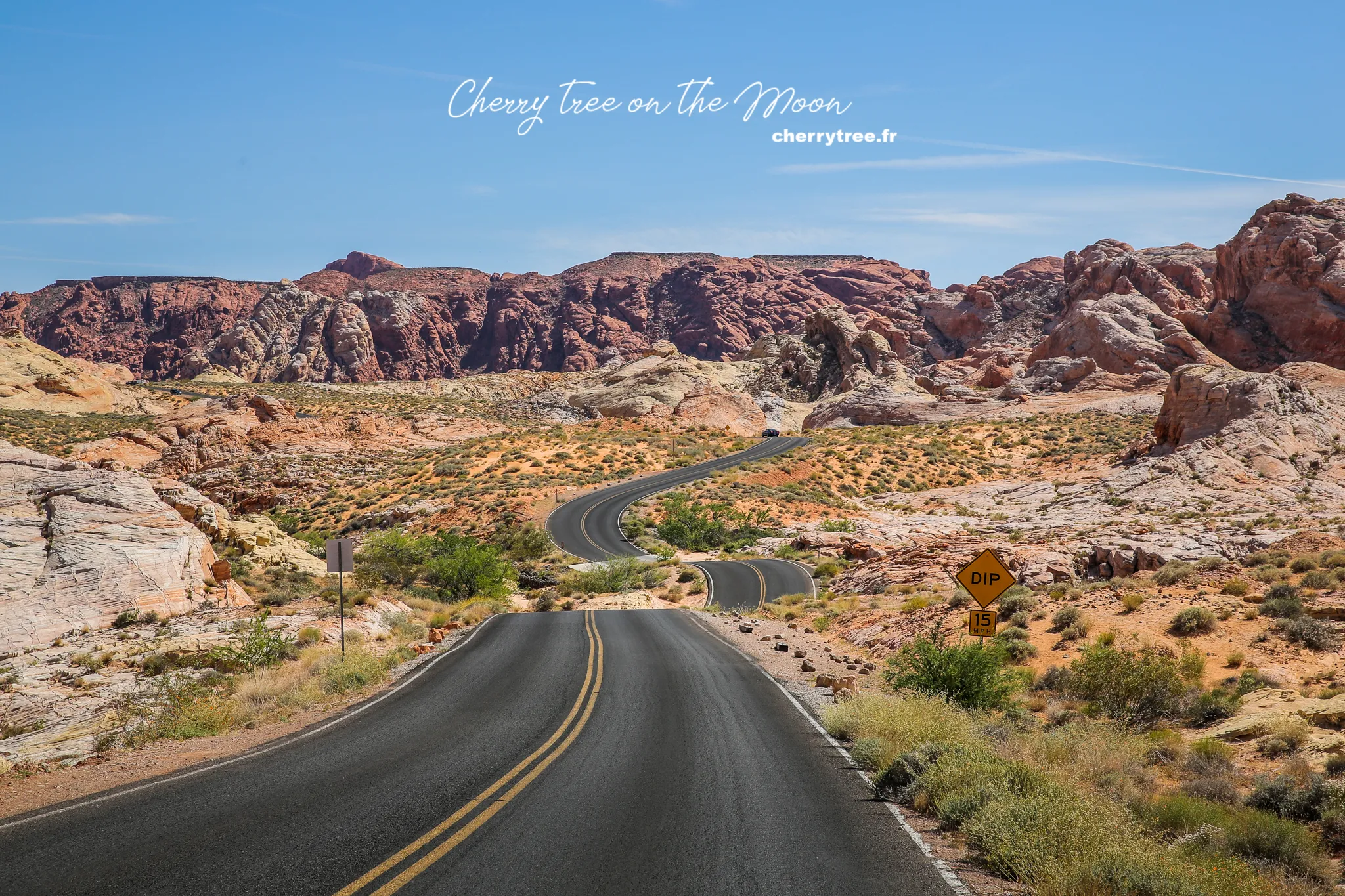
- Las Vegas – Valley of Fire (1h, 56 miles) via NV167: We drove from Las Vegas to Valley of Fire, Nevada State Park, via NV167 to enter the park from the east. Valley of Fire may not be large, but it boasts unique beauty with diverse terrain and special sandstone formations, very “photogenic.” You should spend at least a day exploring the short trails in the area.
- Atlatl rock, Arch rock: Atlatl rock and Arch rock receive the best light in the morning, especially about 30 minutes after sunrise.
- Jumble rock, Elephant rock: Jumble rock and Elephant rock are interesting destinations in the mid-afternoon.
- White dome, Rainbow vista, Fire wave: White dome, Rainbow vista, and Fire wave are most beautiful in the late afternoon until sunset. These are the three most beautiful short trails in Valley of Fire, especially as dusk falls. I chose Fire wave and was completely captivated by the fiery red sandstone in the sunset light.
- Overnight near Valley of Fire: We stayed overnight near Valley of Fire to have more time to explore this park the next day.
Day 6: Zion National Park – Lush Zion National Park
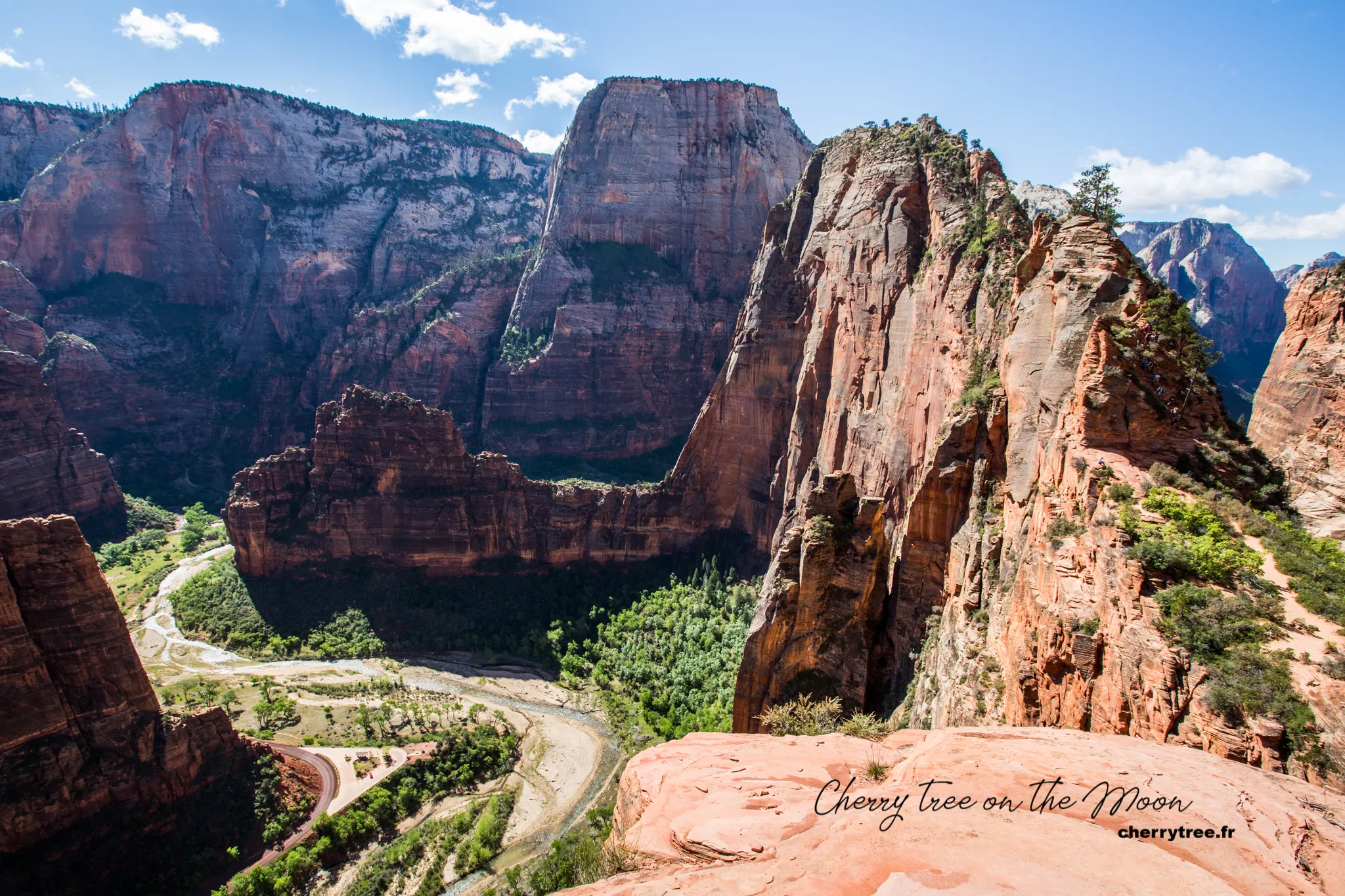
- Valley of Fire – Zion NP (2h30, 140 miles): The next leg of our journey took us to Zion National Park. Zion is the greenest national park in the area, with towering cliffs covered in green pines, reminiscent of European mountains. From spring to autumn, private vehicles are not allowed in Zion Canyon. Instead, the park provides free shuttle buses to take visitors from Zion Canyon Visitor Center to Temple of Sinawava.
- Trekking Angel’s Landing (3-4 hours): Angel’s Landing is Zion’s most famous trail, not only for the beauty at the end but also for its precariousness. There are sections of the trail only 40-50cm wide with 400m deep cliffs on both sides. You should go early in the morning to avoid the heat, as the beginning of the trail is quite steep. Consider carefully before hiking this trail on windy or rainy days. I climbed 2/3 of the way before having to turn back because the wind was too strong, making it impossible to stand firmly. In the afternoon, when hiking at Observation Point looking over, I saw a rescue helicopter hovering over Angel’s Landing, reportedly someone had fallen off the cliff. Sadly, Angel’s Landing often claims the lives of a few people each year.
- Hiking Observation Point (4 hours from Weeping Rock parking lot): In the afternoon, we chose to hike Observation Point, another very beautiful trail in Zion.
- Zion NP – Bryce Canyon (2h, 100 miles): Ending a day exploring Zion, we drove to Bryce Canyon, the next destination on our journey.
- Overnight near Bryce Canyon: We stayed overnight near Bryce Canyon to prepare for a new day exploring this famous national park.
Day 7 & 8: Bryce Canyon National Park – Admiring the Magnificent Hoodoo Forest
Detailed article about Bryce Canyon: US West – Admiring the Hoodoo Forest in Bryce Canyon
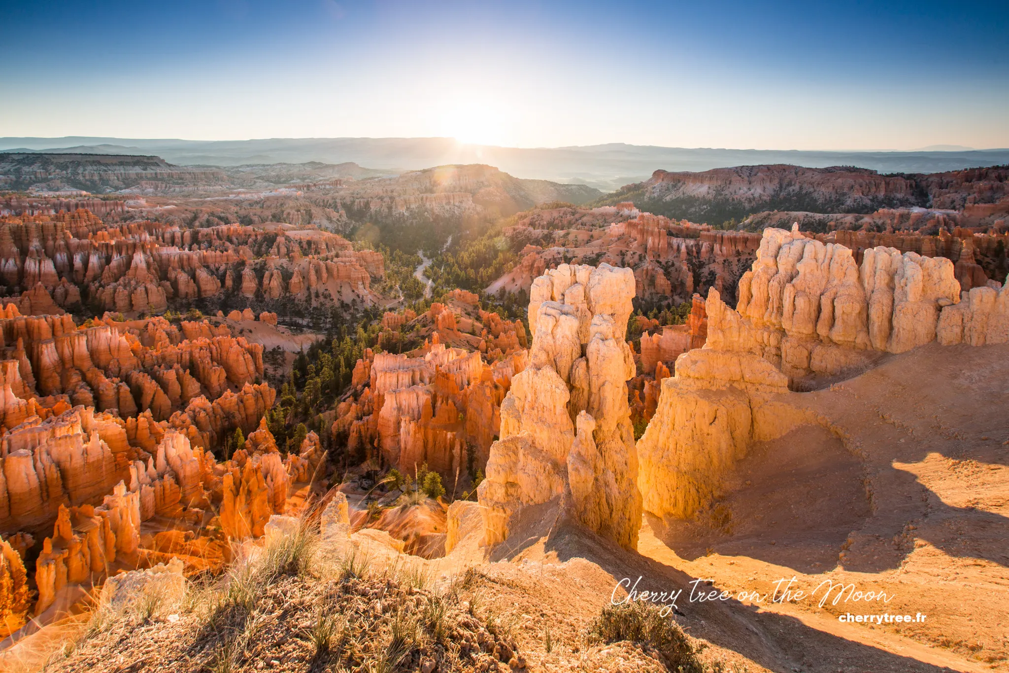
Bryce Canyon is one of the most beautiful national parks in America, famous for its unique landscape, large orange rock columns (hoodoos) standing side by side, unmistakable. Bryce Canyon is located in Utah, covering an area of 145 km². When you come here, you cannot miss the magical sunrise moments at the viewpoints. As the sun rises, the first rays of light filter through the fiery red rock columns, creating an incredibly magnificent scene.
- Day 7:
- Sunrise at Sunrise Point: Sunrise Point is the most famous sunrise viewing spot in Bryce Canyon.
- Hiking Queen Garden trail and Navajo loop trail: From Sunrise Point, we hiked down Queen Garden trail and Navajo loop trail, exploring the hoodoo forest up close.
- Sunset at Sunset Point: Sunset Point is a stunning sunset viewing spot, opposite Sunrise Point.
- Day 8:
- Sunrise at Sunset Point and Inspiration Point: On the morning of the second day, we greeted the sunrise at Sunset Point and Inspiration Point to admire the beauty of Bryce Canyon in the early morning light.
- Bryce Canyon – Moab (5h, 270 miles) via Scenic byway 12: After exploring Bryce Canyon, we drove to Moab, the center of Arches and Canyonlands National Parks, via Scenic byway 12. SB12 is one of the most beautiful roads in America, passing through majestic and wild landscapes, especially the section between Escalante and Boulder. If you have time, you can spend an extra day exploring Escalante National Monument or Capitol Reef National Park on this road.
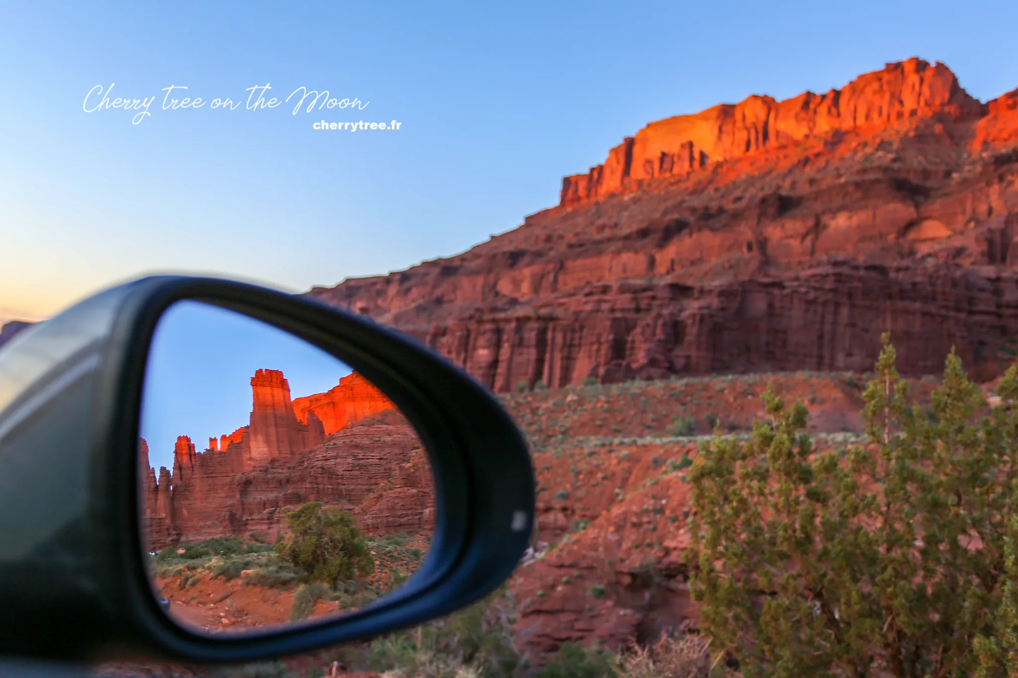
- Sunset at Fisher Tower near Moab: Arriving in Moab in the late afternoon, we managed to catch the sunset at Fisher Tower, a famous photo spot near Moab.
- Overnight in Moab: Moab is an ideal base for exploring the surrounding national parks.
Day 9: Dead Horse Point State Park & Arches National Park – Miraculous Natural Arches
- Moab – Arches NP (9 minutes, 6 miles): On the morning of day 9, we started exploring Arches National Park.
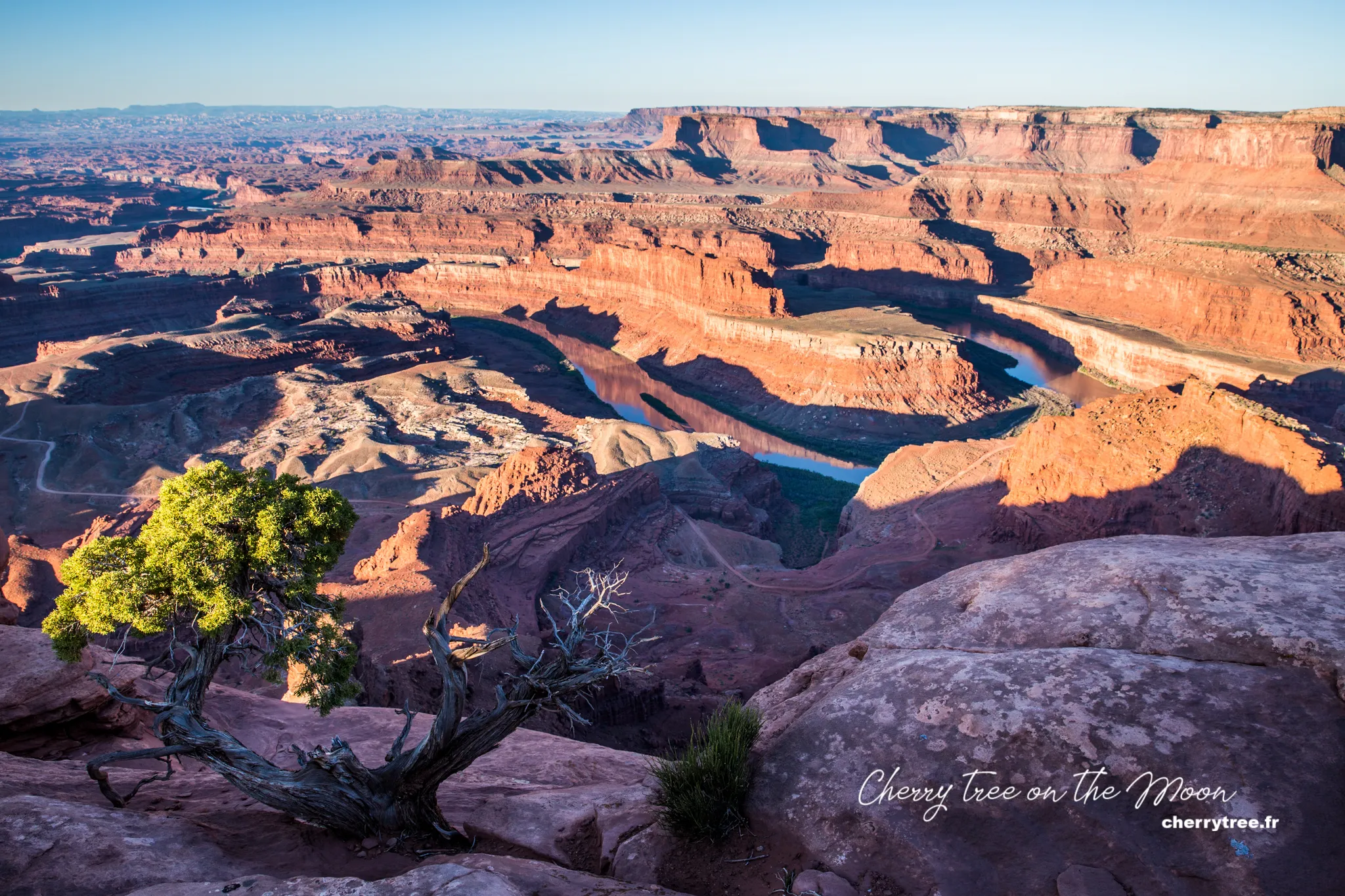
- Sunrise at Dead Horse Point SP: Before entering Arches NP, we stopped at Dead Horse Point State Park to greet the sunrise. Dead Horse Point SP offers a typical image of a Western canyon in America. From the parking lot, walk a few hundred meters further for a better view down to the Colorado River and Manti-La Sal Mountains.
- Arches National Park: Arches NP is a national park with over 2000 natural arches. The red sandstone terrain, eroded by rain and wind for millions of years, has created bizarre and unique shapes.
- Hiking Devil Garden trail (4.2 miles, 6.8 km): We chose to hike Devil Garden trail in the morning to avoid the heat. This is one of the longest and most beautiful trails in Arches, leading to Landscape Arch, the longest natural arch in the world.
- Windows Section and Double Arch: In the afternoon, we explored Windows Section, an area with many beautiful arches, including the famous Double Arch.
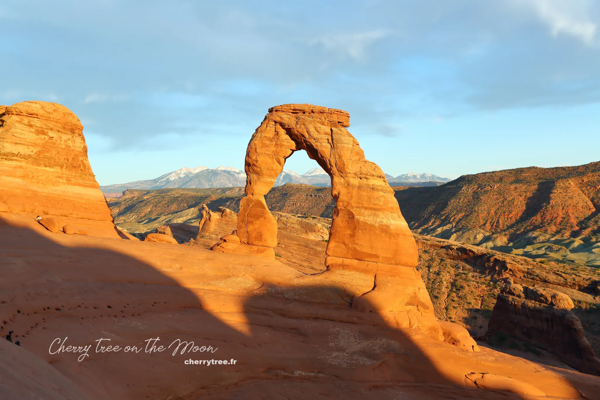
- Hiking Delicate Arch trail (3.0 miles, 4.8 km): Late in the afternoon, we hiked Delicate Arch trail to see Delicate Arch, the symbol of Utah, at sunset. This trail is quite hot and has no shade, remember to bring enough water (at least 1 liter per person).
- Overnight in Moab: We continued to stay overnight in Moab to have more time to explore this area.
Day 10: Canyonlands National Park – Land of Canyons
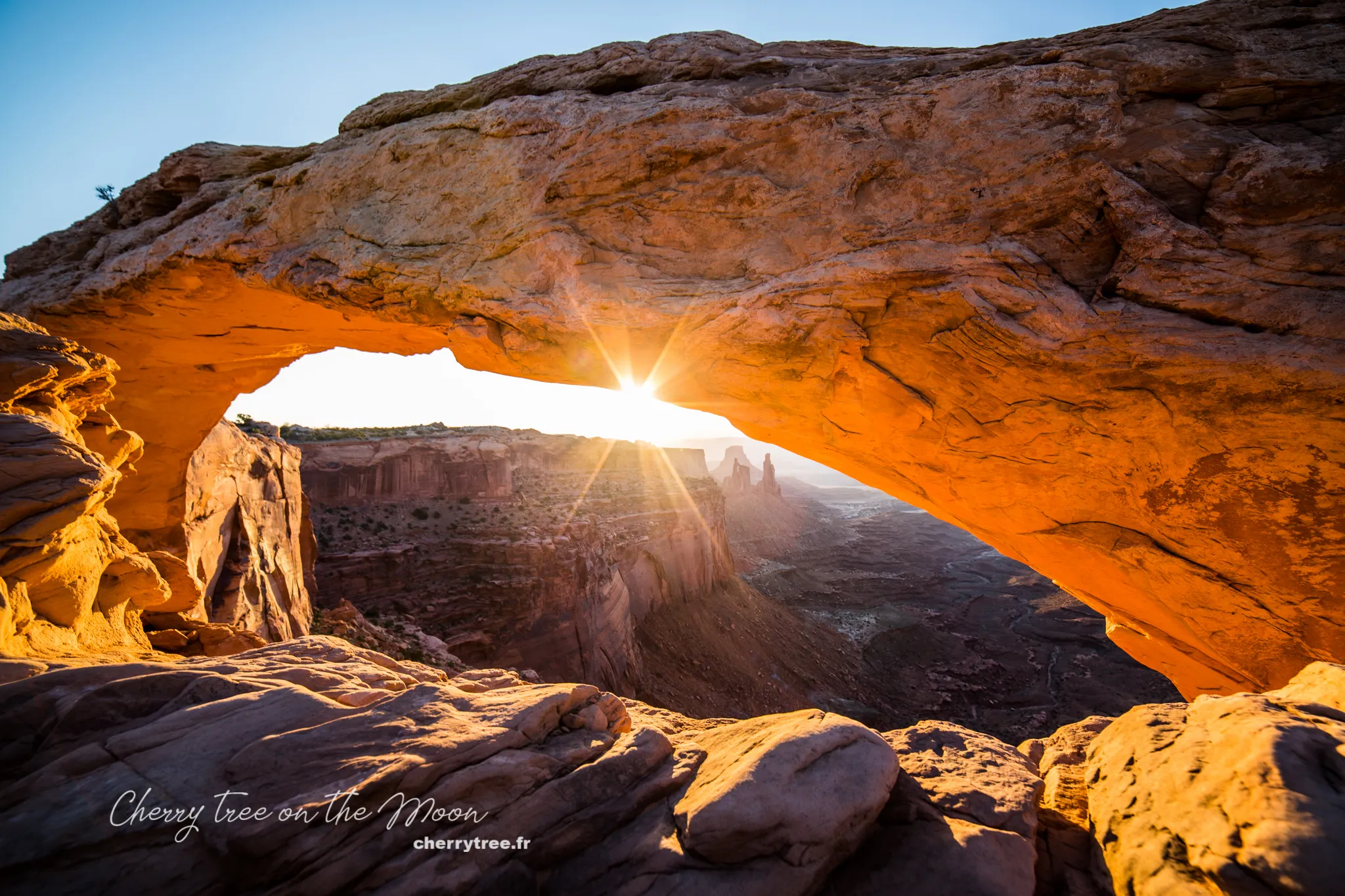
- Moab – Canyonlands NP (45 minutes, 33 miles): Canyonlands is a national park adjacent to Arches NP. Canyonlands lives up to its name “land of canyons,” a collection of countless canyons formed by the erosion of the Colorado and Green Rivers. Canyonlands is vast, consisting of 3 separate districts with 3 different entrances, hundreds of miles apart: Island in the Sky, Needles, and The Maze. Because we had fallen in love with the image of Mesa Arch, we chose to go to Island in the Sky, the most accessible area with many famous attractions.
- Sunrise at Mesa Arch: Mesa Arch is one of the most beautiful arches in America, especially at sunrise. You should arrive here before sunrise to find a good photo spot amidst a “forest” of professional photographers. From the parking lot to the arch takes about 15-20 minutes of walking.
- Other attractions in Island in the Sky: After Mesa Arch, we visited Murphy Point, White Rim Overlook, Grand View Point, Green River Overlook, Shafer Canyon Overlook, each destination offering different perspectives on the majestic landscape of Canyonlands.
- Hiking False Kiva trail (2 miles, 3 km): We also spent time hiking False Kiva trail, a short trail leading to a small cave with stunning views.
- Sunset at Grand View Point or Green River Overlook: To end a day exploring Canyonlands, we watched the sunset at Grand View Point or Green River Overlook, admiring the scenery of one of the most remote and wild lands in the West.
- Canyonlands – Monticello (1h40, 86 miles): Leaving Canyonlands, we drove to Monticello, a small town nearby for overnight stay.
- Overnight in Monticello: Monticello is a more budget-friendly accommodation option compared to Moab, but still convenient for exploring the surrounding destinations.
Day 11: Valley of the Gods, Goosenecks State Park, Monument Valley Navajo Tribal Park – Journey to the Iconic Western Land
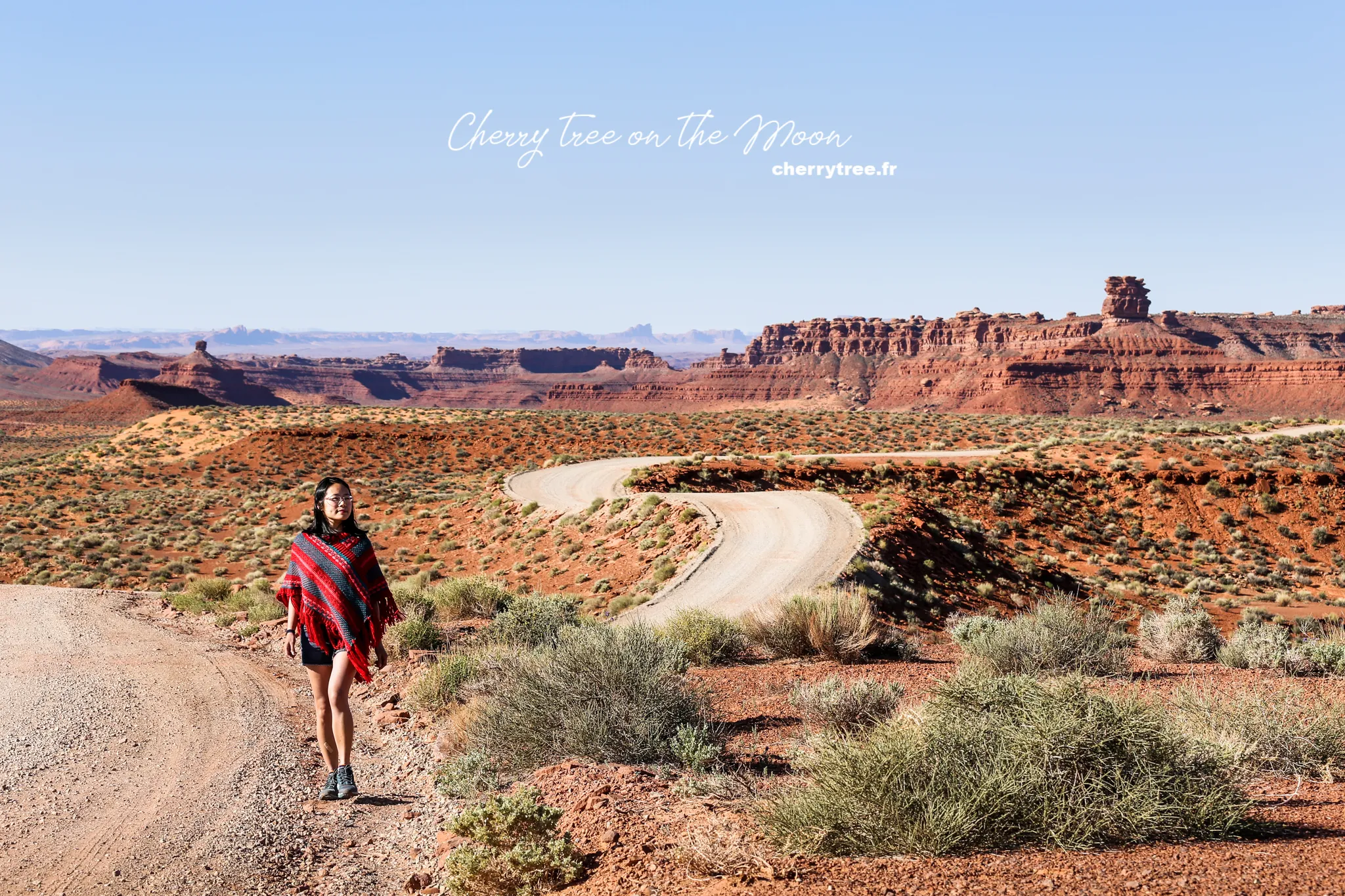
- Monticello – Monument Valley (1h50, 96 miles) via Valley of the Gods: On the way to Monument Valley, we stopped at Valley of the Gods. https://utah.com/monument-valley/valley-of-the-gods is located on Highway 163, turn into Valley of the Gods road. Valley of the Gods has similar beauty to Monument Valley but is completely free and less crowded with tourists.
- Goosenecks State Park: Continuing our journey, we stopped at Goosenecks SP at the intersection of Highway 163 and Highway 261. Goosenecks State Park is famous for the gooseneck bends of the San Juan River.
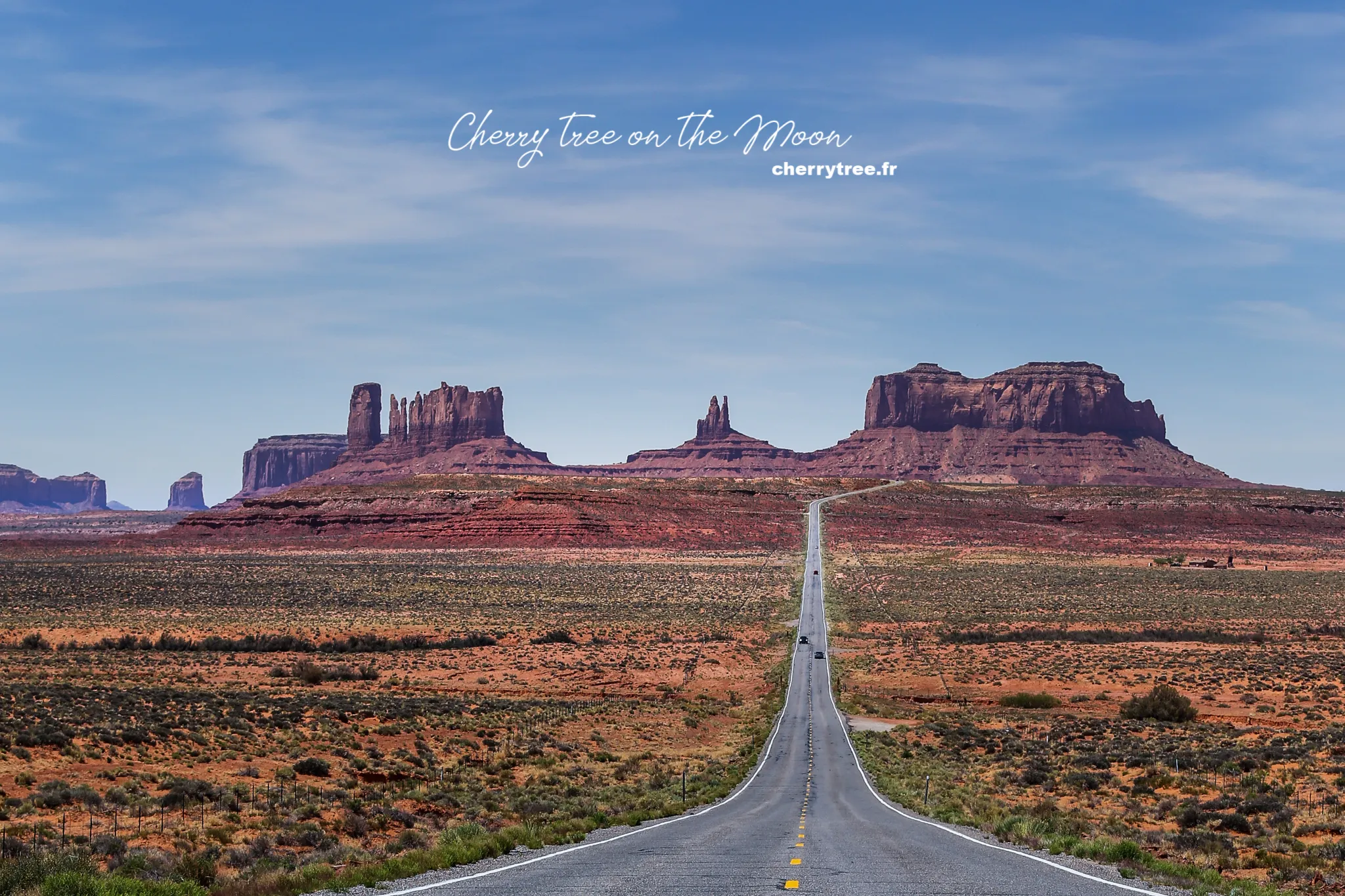
- Monument Valley Navajo Tribal Park: Monument Valley, also known as Tse’ Bii’ Ndzisgaii in Navajo, is a symbol of the American Southwest. This place has become a familiar backdrop in hundreds of movies, music videos, and magazine covers. Monument Valley is owned by the Navajo Nation, so there are separate regulations different from national and state parks.
- Hiking Wildcat trail (4 miles, 6 km): We chose to hike Wildcat trail, one of the most beautiful trails in Monument Valley, to explore the pristine beauty of the valley up close.
- Scenic Drive Monument Valley: Late in the afternoon, we drove a loop of Monument Valley via Scenic Drive to admire the giant sandstone buttes in the twilight.
- Sunset at viewpoint in front of Visitor Center Monument Valley: The best sunset viewpoint in Monument Valley is right in front of the Visitor Center, where you can admire the panoramic view of the legendary valley.
- Overnight in Monument Valley: To fully enjoy the beauty of Monument Valley, we decided to stay overnight here.
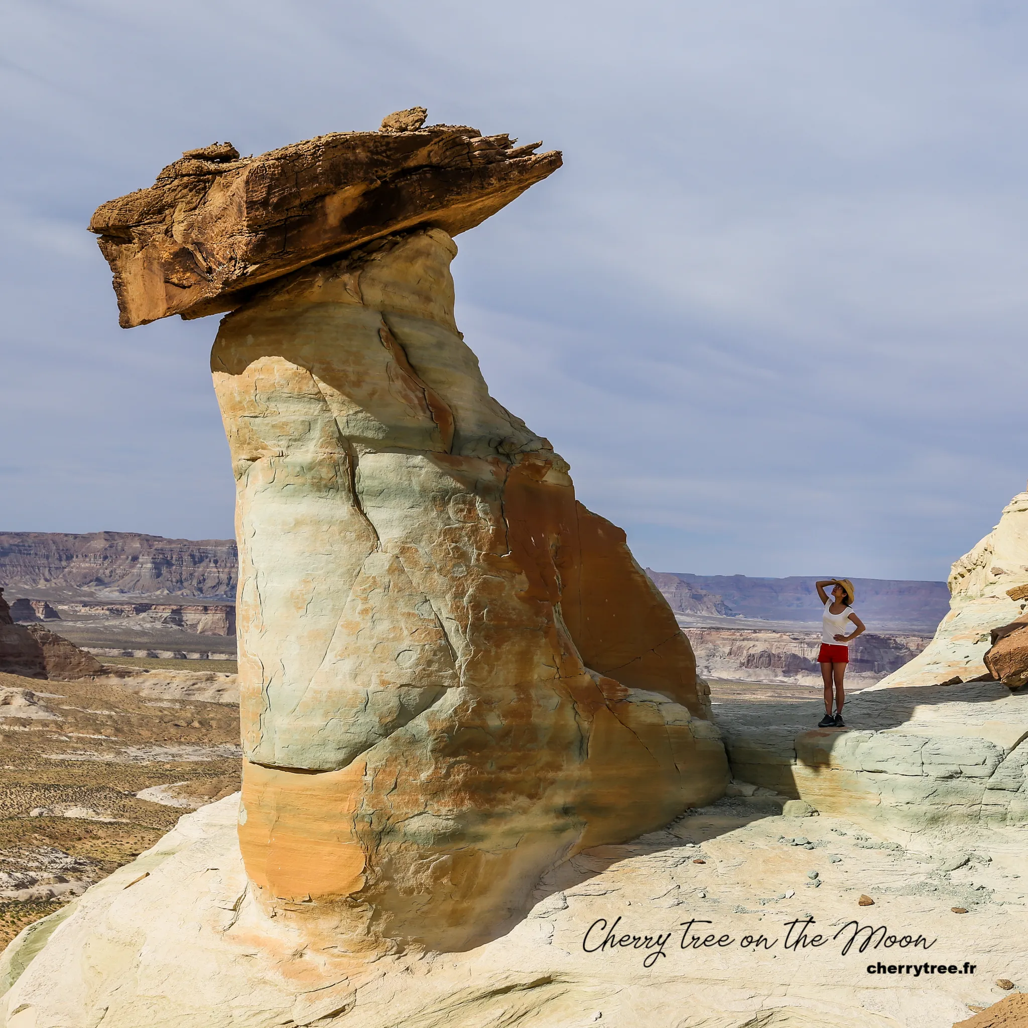
Day 12: Page, Arizona – Exploring Thousand Pockets and Stud Horse Point
- Monument Valley – Page (2h, 126 miles): On day 12, we drove to Page, a small town in Arizona, famous for Lake Powell, Antelope Canyon, and Horseshoe Bend.
- Thousand Pockets: Arriving in Page, we spent time hiking Thousand Pockets (2 miles, 3 km), a unique sandstone terrain area with small rock “pockets” formed by erosion.
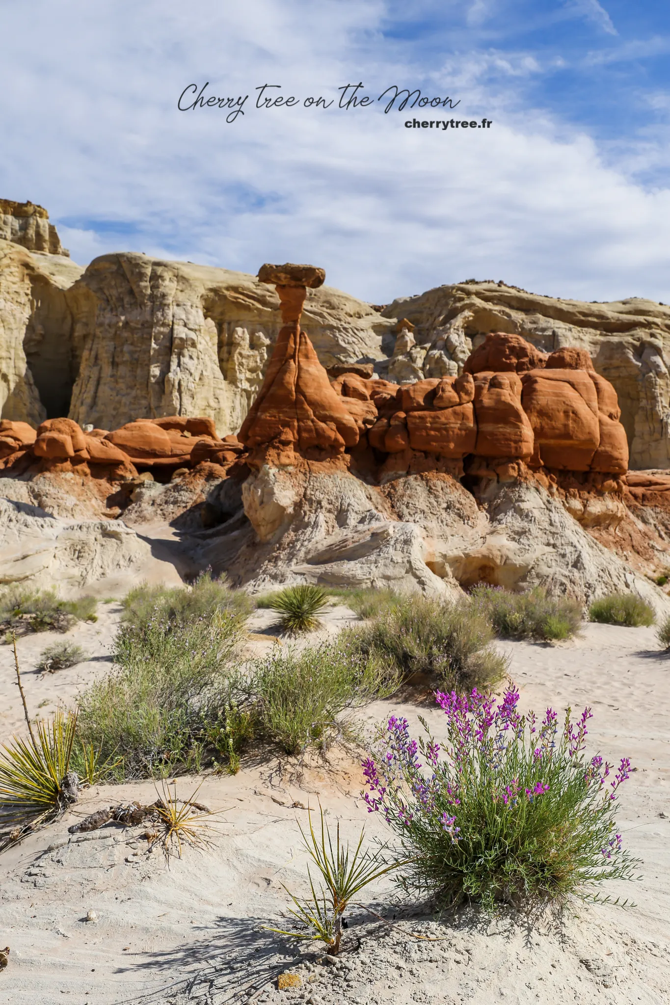
- Stud Horse Point: Stud Horse Point is a lesser-known destination but also worth visiting, with bizarre sandstone pillars.
- Overnight in Page: Page is a tourist hub with many hotel and restaurant options.
Day 13: Antelope Canyon Navajo Tribal Park – Mystical Antelope Canyon
Detailed article about Antelope Canyon: US West – Visiting and Photographing Antelope Canyon
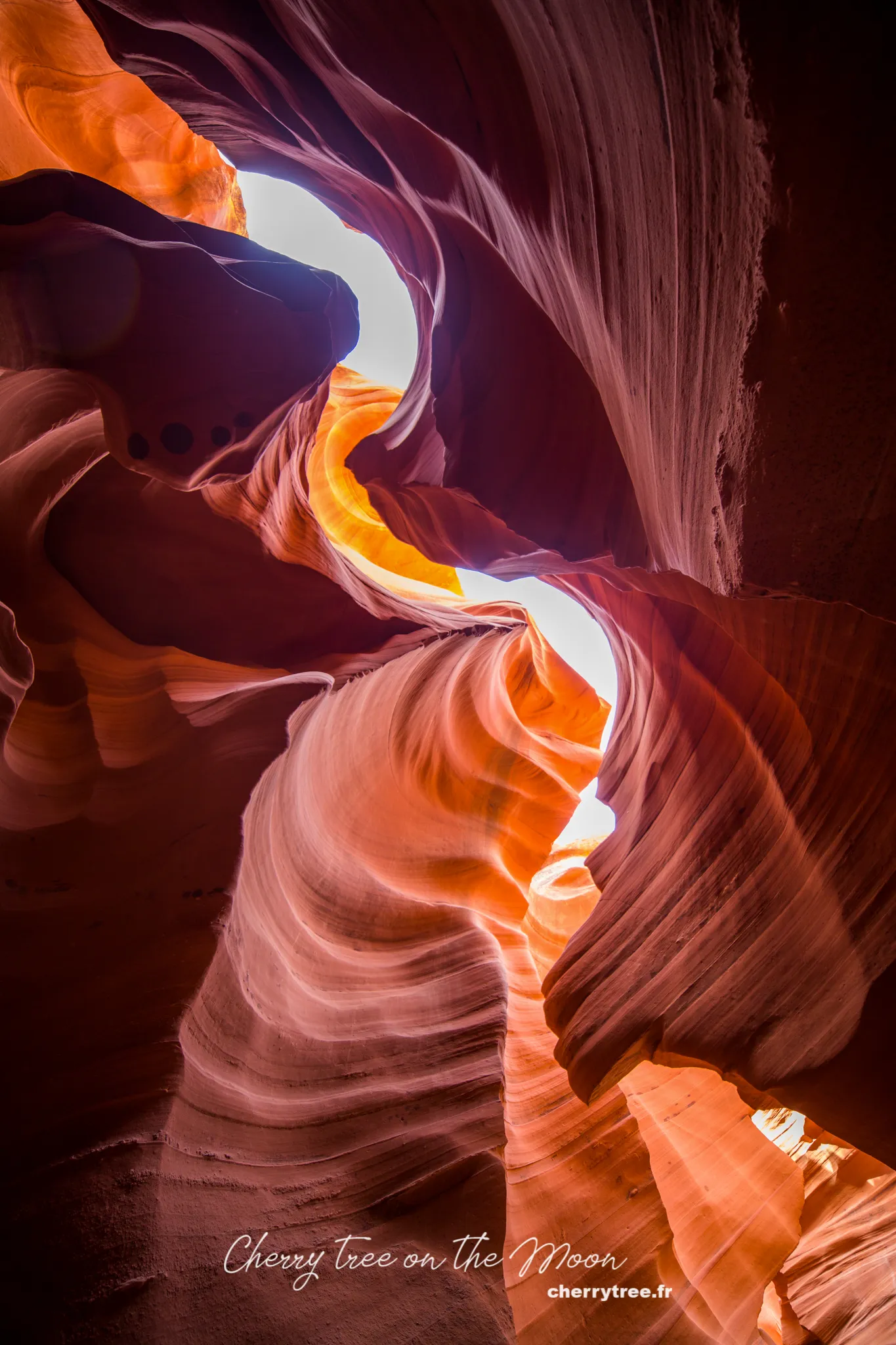
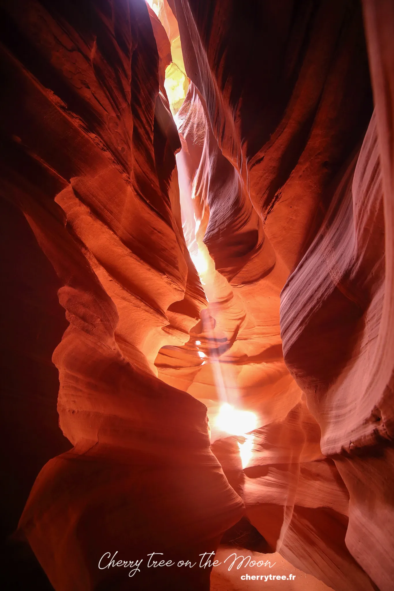
Antelope Canyon is two stunning narrow slot canyons formed by wind and water erosion. Antelope Canyon is also managed by the Navajo Nation. In the past 10 years, Antelope Canyon has become increasingly famous, attracting large numbers of tourists from all over the world. Entrance fees have also increased significantly (about 30-40 USD in 2014).
- Lower Antelope Canyon (Hasdeztwazi): In the morning, we visited Lower Antelope Canyon (Hasdeztwazi). Previously, there was a photo pass tour allowing visitors to freely roam the canyon, but since 2018, this tour is no longer offered for Lower AC.
- Upper Antelope Canyon (Tse Bighanilini’): At noon, we explored Upper Antelope Canyon (Tse Bighanilini’). The best time to visit Upper Antelope Canyon is from 11 am to 1 pm, when sunlight shines directly down to the canyon floor, creating magical light beams. However, if you want to enter Upper AC during the prime time, you need to book a tour many months in advance.
- Overnight in Page: We continued to stay overnight in Page to have more time to explore this area.
Day 14: Lake Powell & Horseshoe Bend – Beauty by the Colorado River
- Lake Powell boat tour: In the morning, we joined a boat tour exploring Lake Powell. Lake Powell is a vast artificial lake created by the Glen Canyon Dam on the Colorado River. Cruising on Lake Powell is an enjoyable experience, allowing you to admire the majestic scenery of Glen Canyon from the water.
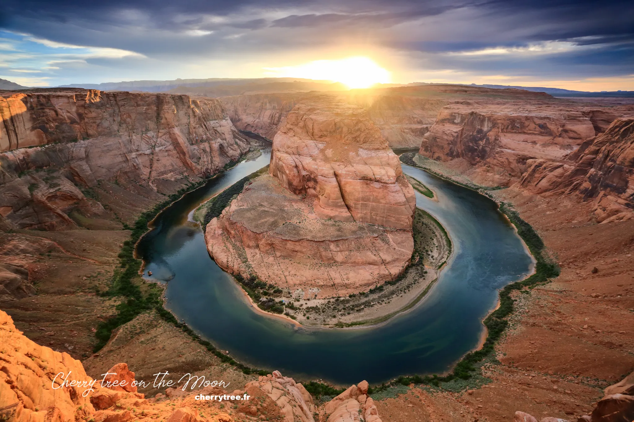
- Sunset at Horseshoe Bend: In the afternoon, we went to Horseshoe Bend to greet the sunset. Horseshoe Bend is a famous horseshoe-shaped meander of the Colorado River, creating a spectacular scene.
- Overnight in Page: On night 14, we stayed in Page again.
Day 15, 16 & 17: Grand Canyon National Park – Majestic Grand Canyon
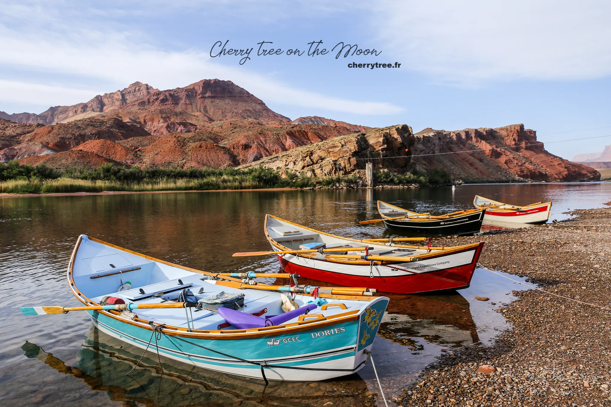
- Day 15: Page – Grand Canyon South Rim (2.5 h, 133 miles): The next leg of our journey took us to Grand Canyon National Park. Grand Canyon – The Great Canyon, created by the erosion of the Colorado River into the mountains, is the largest canyon in America. No words or lenses can fully capture the magnificence and overwhelming scale of the scenery here.
- Lee’s Ferry: On the way to the Grand Canyon, we stopped at Lee’s Ferry, an important historical site where people used to cross the Colorado River. Today, Lee’s Ferry looks like a peaceful little boat dock in the national park.
- Hiking Cathedral Wash (2.5 miles, 3.75 km): We spent time hiking Cathedral Wash, a short trail leading through a small canyon as beautiful as a natural church.
- Desert View: Stopped at Desert View, 22 miles from the Grand Canyon, to admire the scenery and take photos in the afternoon. The afternoon light highlights the geological layers of the Grand Canyon.
- Overnight in Grand Canyon Village: We stayed overnight in Grand Canyon Village, the central area of Grand Canyon South Rim, for easy access to explore the great canyon in the following days.
- Day 16:
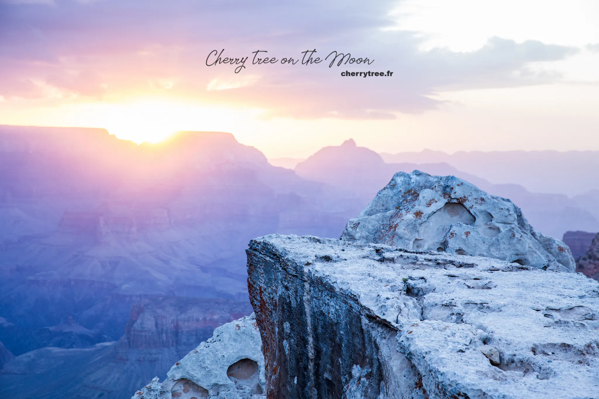
- Sunrise at Mather Point: Mather Point is one of the most popular sunrise viewing spots at Grand Canyon South Rim.
- Hiking Bright Angel trail to 3-miles Resthouse: We chose to hike Bright Angel trail, one of the most famous trails down into the Grand Canyon. We went to 3-miles Resthouse and back (total 6 miles, 9.6 km).
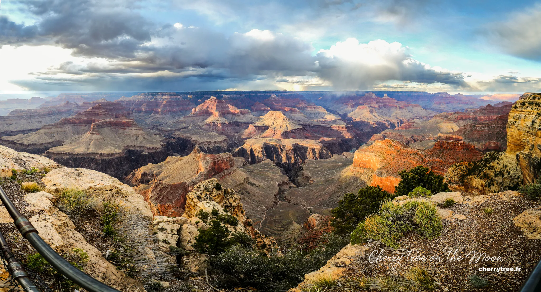
- Sunset at Hopi Point: Hopi Point is a stunning sunset viewpoint at the Grand Canyon, especially after rain, when the sky and canyon reflect vibrant colors.
- Overnight in Grand Canyon Village: Night two at the Grand Canyon, we still stayed at Grand Canyon Village.
- Day 17:
- Sunrise at Yaki Point: Yaki Point is another very beautiful sunrise viewing spot at the Grand Canyon, less crowded than Mather Point.
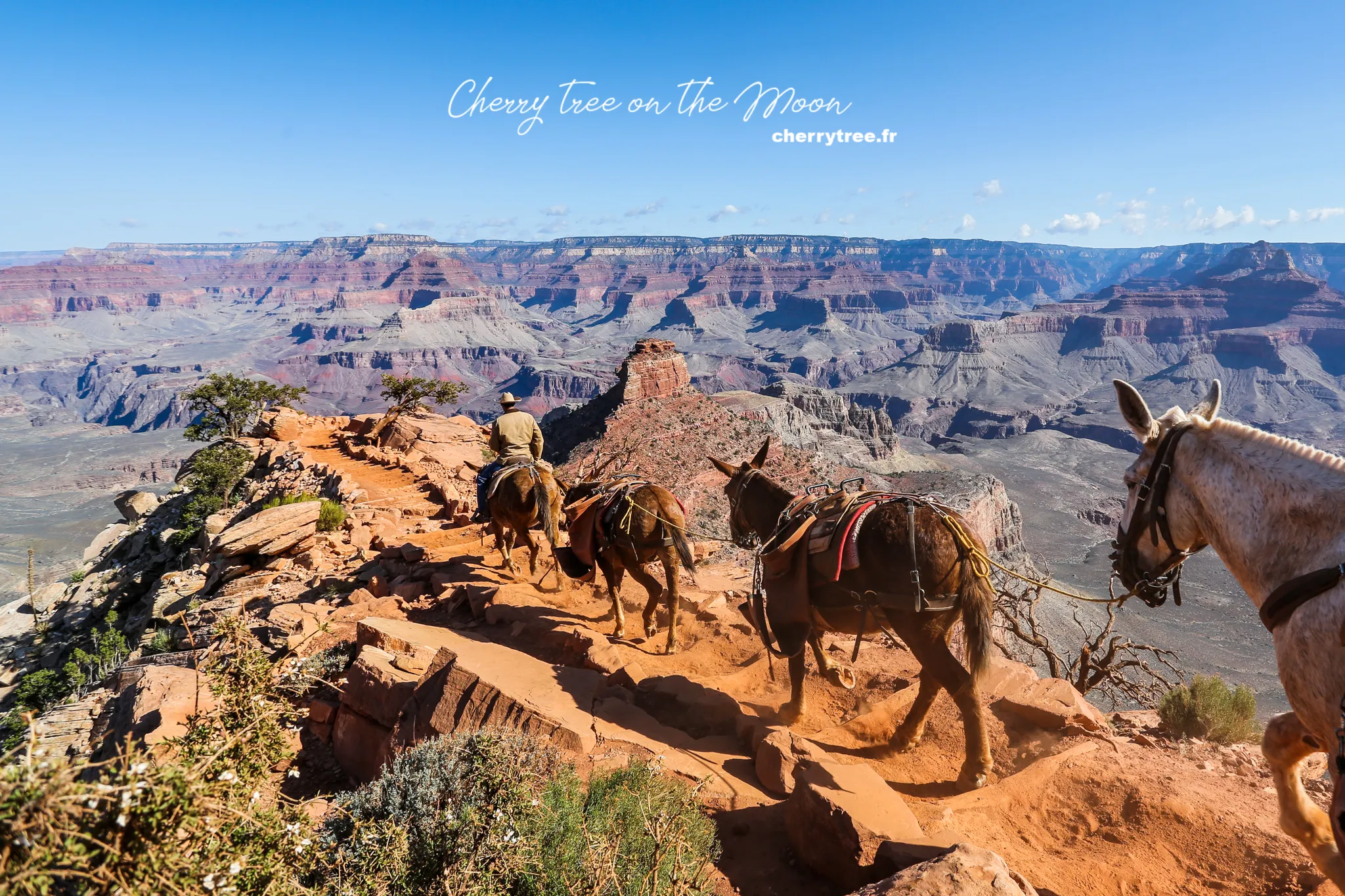
- Hiking South Kaibab trail to Cedar Ridge: We continued exploring the Grand Canyon by hiking South Kaibab trail to Cedar Ridge and back (total 3 miles, 4.8 km). South Kaibab trail is famous for its spectacular views when descending into the canyon.
- Trail of Time from Verkamp’s Visitor Center to Yavapai Point: In the afternoon, we strolled Trail of Time, an easy walking trail, connecting Verkamp’s Visitor Center and Yavapai Point, with information panels about the geological history of the Grand Canyon.
- Sunset at Yavapai Point: Yavapai Point is an ideal sunset viewpoint, where you can admire the panoramic Grand Canyon and learn about the geology of the area at the Yavapai Geology Museum.
- Overnight in Grand Canyon Village: Our last night at the Grand Canyon, we still chose to stay at Grand Canyon Village to enjoy the fresh and peaceful atmosphere of this national park.
Day 18: Route 66 – Journey on the Legendary Road
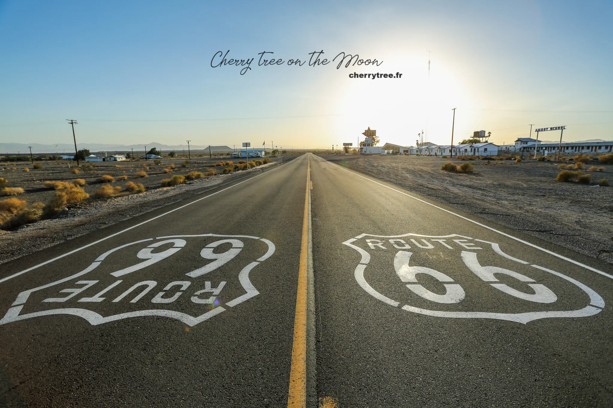
- Grand Canyon – Williams – Twentynine Palms (8h, 480 miles): Leaving the Grand Canyon, we began our journey on the legendary Route 66.
- Route 66: We drove along Route 66, visiting historic towns like Seligman, Hackberry, Kingman, Oatman, Essex, Newberry Springs. Route 66, also known as “Main Street of America” or “The Mother Road,” is a symbol of American culture and history.
- Overnight in Twentynine Palms: Twentynine Palms is a small town near Joshua Tree National Park, an ideal stop before exploring this national park.
Day 19: Joshua Tree National Park – Unique Joshua Tree Garden
- Twentynine Palms – Joshua Tree National Park: Joshua Tree National Park is a unique national park, famous for its bizarre Joshua trees and giant granite boulders.
- Hidden Valley & Cholla Cactus Garden: We explored Hidden Valley, a hidden granite boulder valley, and Cholla Cactus Garden, a garden filled with unique Cholla cacti.
- Joshua Tree NP – Santa Ana (2h, 140 miles): Leaving Joshua Tree, we drove towards Los Angeles, stopping at Santa Ana.
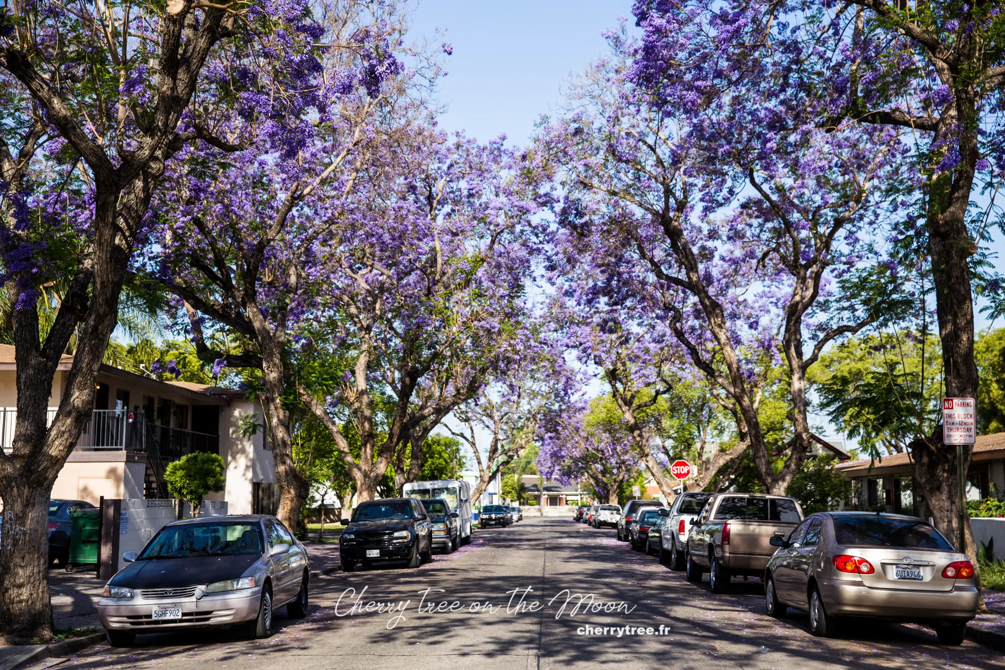
- Santa Ana Jacaranda trees: If you visit Santa Ana in May, don’t miss the opportunity to see the brilliant purple jacaranda blossoms on Myrtle Street and Morrison Park.
- Santa Ana – Los Angeles (1h, 40 miles): From Santa Ana, we drove back to Los Angeles.
- Overnight in Los Angeles: We stayed overnight in Los Angeles, preparing for the final days of our trip.
Day 20 & 21: Los Angeles – End of the Journey
- Day 20 & 21: We spent the last two days exploring Los Angeles, visiting famous landmarks like Hollywood, Beverly Hills, Santa Monica, Venice Beach…
- Day 21: Returned the rental car in Los Angeles and ended our 3-week road trip exploring the American Southwest.
Kayaking Experience on the Green River
Besides trekking and long-distance driving, the American Southwest also offers exciting water experiences, especially kayaking on the Green River. The Green River, a major tributary of the Colorado River, flows through majestic canyons and vast deserts, creating a unique and impressive natural landscape.
Why kayak on the Green River?
- Explore Canyonlands from a different perspective: The Green River flows through Canyonlands National Park, offering the opportunity to explore this national park from the water. You will admire towering sandstone canyons, natural arches, and pristine sandy beaches from a completely new angle.
- Adventurous and exciting experience: Kayaking on the Green River is not just a sport but also an adventurous journey. You will navigate small rapids, explore winding river sections, and enjoy the feeling of freedom amidst wild nature.
- Connect with nature: Kayaking is a great way to immerse yourself in nature. You will be close to the river, listen to the sound of flowing water, watch birds and wildlife, and enjoy the fresh air of the Southwest.
- Suitable for many skill levels: The Green River has many different river sections, suitable for many kayaking skill levels, from beginners to professional athletes. You can choose kayak tours that suit your experience and preferences.
Popular kayak tours on the Green River:
- River section through Stillwater Canyon (Canyonlands National Park): This is the most popular river section for kayak tours in Canyonlands. This section of the river is quite calm, suitable for beginners and families with children. Tours usually last from 1 to several days, taking you to explore the pristine beauty of Stillwater Canyon.
- River section through Labyrinth Canyon: Labyrinth Canyon is a more remote and wild river section than Stillwater Canyon, suitable for those who like adventure and exploration. Kayak tours in Labyrinth Canyon usually last several days and require certain kayaking experience.
- Kayak and camping tours: Many tour companies offer kayak and camping tours on the Green River. This is a great way to experience the wild nature in the most complete way. You will kayak during the day, camp by the riverbank at night, and admire the beautiful starry sky of the Southwest.
Tips for kayaking on the Green River:
- Choose the right time: The best time to kayak on the Green River is in spring (April-May) and autumn (September-October), when the weather is cool and pleasant. Summer can be very hot, especially in the middle of the day.
- Prepare adequate equipment: You need to prepare a kayak, life jacket, hat, sunglasses, sunscreen, drinking water, snacks, and weather-appropriate clothing. If you are going on a multi-day tour, you need to prepare additional camping gear, sleeping bags, and personal items.
- Book a tour with a reputable company: If you do not have kayaking experience or want to explore more challenging river sections, book a tour with a reputable tour company. They will provide you with equipment, professional guides, and ensure safety for your trip.
- Pay attention to safety: Always wear a life jacket when kayaking, follow the guide’s instructions, and avoid kayaking in bad weather.
Kayaking on the Green River is an unmissable experience when exploring the American Southwest. Challenge yourself with this adventurous activity to discover the majestic beauty of nature from a unique and memorable perspective.
Best Time to Visit the American Southwest
The Grand Circle has mountainous and desert terrain, so the weather is quite harsh. Spring (March to May) and autumn (September to November) are the two best seasons for a road trip. Summer months (June, July, August) are very hot, especially in the Death Valley area, daytime temperatures can reach 40-50°C. Winter is cold and snowy, which can be dangerous if you are not used to driving on icy roads.
Park Entrance Fees
National Parks and Monuments
National parks and monuments all have entrance fees, usually from 5 to 10 USD. Fees can be per person or per vehicle. If you plan to visit many national parks on your trip, you should purchase the America the Beautiful Pass.
America the Beautiful Pass:
- Price 80 USD
- Valid for 1 year from the date of purchase
- The pass is valid immediately after payment
- Usable in all federally managed areas across the United States (not applicable to state or Native American areas)
- Purchase at the visitor information center (Tourism office) of the first national park you visit
- The pass includes entrance fees for 1 vehicle and up to 7 people
- See the list of applicable areas and detailed information here.
State Parks and Monuments
The America the Beautiful Pass does not apply to state parks and monuments. You need to purchase separate tickets on-site, usually priced from 5 to 10 USD/vehicle.
Navajo Nation Parks
Navajo Nation parks, such as Monument Valley and Antelope Canyon, are not federally managed but managed by the Navajo people. Entrance fees are usually higher and tend to increase over time. The entrance fee to Monument Valley is currently 20 USD/vehicle (up to 4 people), from the 5th person onwards, an additional fee of 6 USD/person applies.
Accommodation Options
Hotels
I usually book hotels on online booking websites like Booking, Agoda, or Expedia. Booking is the website I find has the most options that suit my needs.
If you book through Booking, you can use my referral link to get a €15 discount for your first booking: https://www.booking.com/s/35_6/huyenc30
Or use this link to get a 10% discount for your first booking: https://www.booking.com/s/12_6/buicam61
National Park Lodges (NP Lodge)
National parks often have lodge areas with many types of rooms, located right within the park grounds. NP Lodges are usually priced slightly higher than hotels outside, but have convenient locations, making it easy for you to explore the park for many days. You can directly access the website of each park to view prices and book rooms.
Camping in National Parks (Camping)
If you want to save costs, camping is a great option. National parks all have one or more campsites, well-equipped with amenities such as electricity, water, bathrooms, and clean toilets. Camping is a great experience for those who love backpacking travel. You only need to prepare a tent, mattress, cooking utensils, and a warm sleeping bag (as nighttime temperatures in the desert can drop quite low).
Renting a Car for Self-Driving in the US
I usually rent a car through Rentalcars. This website provides quite good service, listing many car rental companies for you to choose from. I will share my experience renting and driving in the US in another detailed article.
Sample Costs for a 3-Week Trip (for 2 people)
- Round-trip airfare from Europe: 800 – 1000 USD
- Hotel: 50 – 100 USD/night
- Food: 10 – 20 USD/person/meal
- Car rental: 40 – 50 USD/car/day
Estimated total cost for a 3-week trip is approximately 5600 USD for 2 adults.
Reference Books and Websites
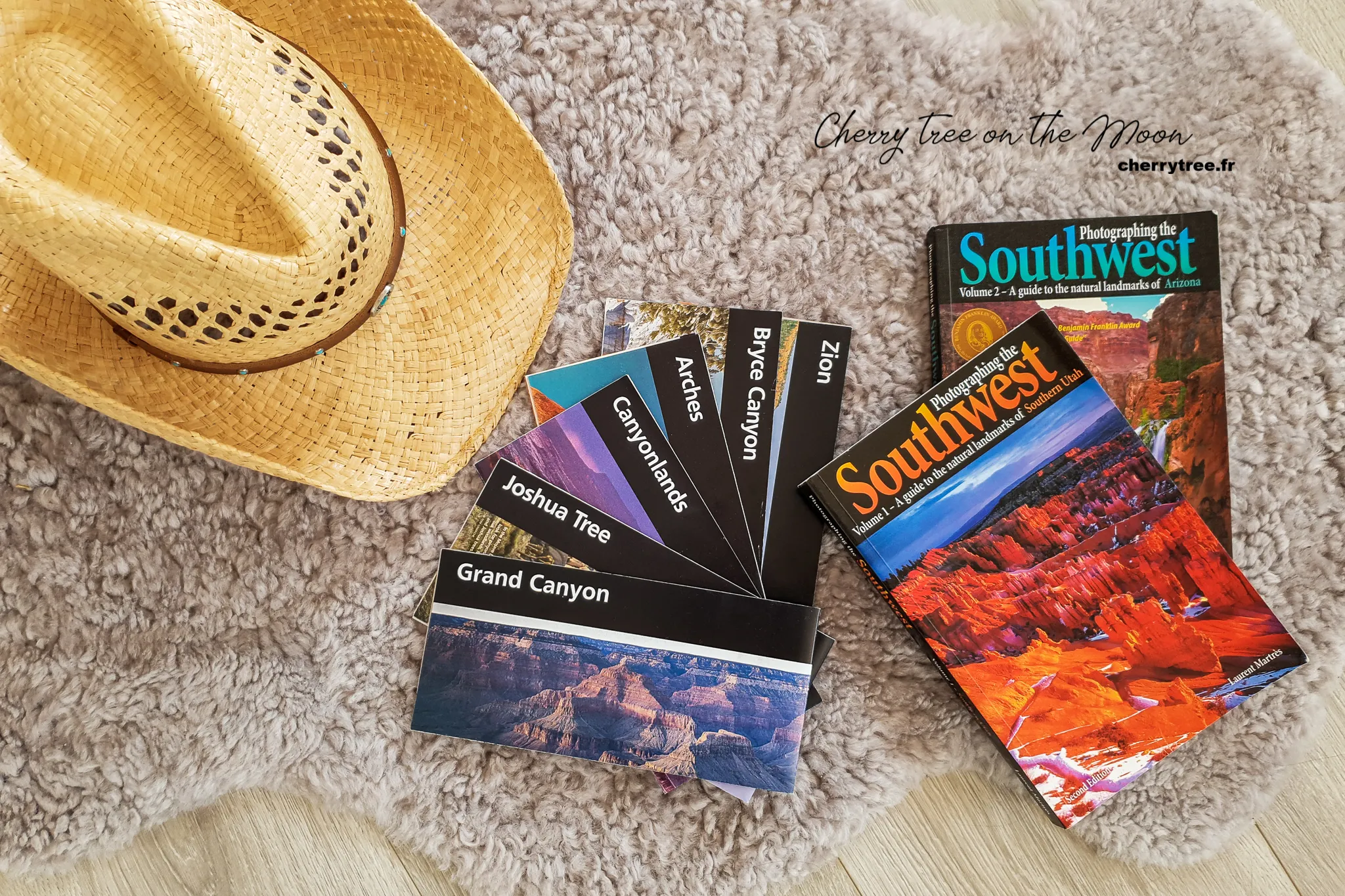
To prepare for this first road trip, I read many websites and reference books. Among them, the “Photographing the Southwest” series of 3 books by Laurent Marthès was the most useful resource for photography enthusiasts like me.
If you know French, the website RoadTrippin is an “encyclopedia” of road trips in America, where you can find a lot of useful information.
I still keep many maps of the national parks I have visited. If you need them, message me so I can scan and send them to you.
Related Articles
Detailed article about Bryce Canyon: US West – Admiring the Hoodoo Forest in Bryce Canyon
Detailed article about Antelope Canyon: US West – Visiting and Photographing Antelope Canyon
Wishing you a truly interesting and memorable trip to the American Southwest! If you have any questions, don’t hesitate to leave a comment below. 😉
(A portion of this article was published in Elle magazine 2019)